C.Scope MXL4-DBG Datalogging Bluetooth Multi Frequency Locator

- Picks up 131kHz, 33kHz, 8kHz, 640Hz and 512Hz frequency signals
- Integrated GPS plus Bluetooth connectivity to local GPS Survey equipment
- Datalogging to internal 2GB memory, data transfer via USB or Bluetooth®
Use reward points to get money off future purchases.
Please note: Customers must be signed into their account to be elegible. Find out more about reward points here.
Found this product cheaper & in stock somewhere else? Give us the details and we'll endeavour to match the price.
To price match, contact us online or call 0113 248 9966.
We offer FREE standard delivery on all orders over £249, with a range of next-day options also available on many items.
Find out more on our delivery information page.
We want our customers to be fully satisfied with the goods they purchase from us, offering returns for up to 60 days.
Find out more about our refunds policy here.
We're always happy to offer help, information & advice to find the right instrument for you, so please get in touch.
To speak to our sales team, call us on 0113 248 9966, use our Live Chat service or contact us online.
C.Scope MXL4-DBG Datalogging Bluetooth Multi Frequency Locator
The C.Scope MXL4-DBG Datalogging Bluetooth Multi Frequency Locator is a handy cable locator which can find and trace a wide variety of different cables and pipes. This is thanks to its capacity to receive a wide frequency range of signals. The locator is extremely sensitive and is highly accurate even in noisy environments.
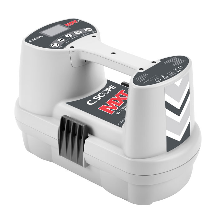
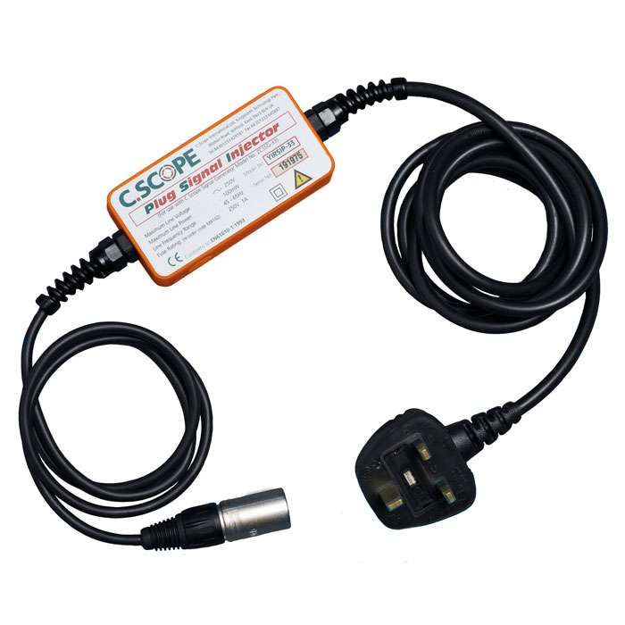
A general 33kHz signal can be detected by the C.Scope MXL4-DBG and a 131kHz high-frequency signal is ideal for detecting thin, short or unearthed cables. For longer thicker cables, meanwhile, an 8kHz frequency is available and two ultra low frequency signals (512Hz and 640Hz) have specialist applications in cable tracing like finding blockages in subterranean metal pipes. Signals and energisation are projected by the C.Scope MXT4 Transmitter.
Alongside transmitter mode, the C.Scope MXL4-DBG can be used as a standalone instrument in radio and power modes. Power mode detects signals emitted by live electric current in underground cables and radio mode can detect radio-type signals from buried metal surfaces. AllScan mode is also available which has a wider frequency detection range than the other three modes for more comprehensive inspection.
Depth indication from 0.1m to 9.99m is another important aspect of the C.Scope MXL4-DBG. It works in combination with peak hold to accurately find and trace the path of buried cables and pipes. Additionally, AlarmZone™ alerts sound when an underground obstacle is particularly shallow and the swing indicator prevents improper use affecting accuracy.
The C.Scope MXL4-BDG saves readings and activity to its 2GB internal memory which has enough space for roughly 12 months’ data at normal usage levels, all of which can be recalled to the backlit LCD screen at the user's discretion. The integrated GPS functionality can add a location stamp to saved readings and Bluetooth® connectivity with local GPS Survey equipment allows ‘one-pass’ underground utility surveys. Data transfer can be undertaken via Bluetooth to a smart device with the C.Scope Relay App or via USB to a PC with C.Scope PC Toolkit software.
Daily self tests ensure accuracy and mean there is no need to calibrate the C.Scope MXL4-DBG. It is ideal for use in poor weather conditions thanks to its IP65-rated weatherproof casing and it has a three-year warranty. A C.Scope MXT4 Transmitter can be added to the purchase by clicking on the checkbox above.
Key Features
- Radio, power, transmitter, AllScan modes
- Compatible frequencies: 131kHz, 33kHz, 8kHz, 640Hz and 512Hz
- Depth measurement range: 0.1m to 9.99m
- Depth measurement accuracy: ±5%
- Depth measurement resolution: 0.1m
- Peak hold
- AlarmZone™ shallow obstacle warning
- Swing indicator
- Datalogging to 2GB internal memory
- In built GPS
- Bluetooth® connectivity to local GPS Survey equipment
- Data transfer via Bluetooth® or USB
- IP65 weatherproof rating
- Automatic daily self test
- Three-year warranty
| CXL4 | CXL4-D | CXL4-DBG | DXL4-D | DXL4-DBG | MXL4-D | MXL4-DBG | |
|---|---|---|---|---|---|---|---|
| Power Mode | ✔ | ✔ | ✔ | ✔ | ✔ | ✔ | ✔ |
| Radio Mode | ✔ | ✔ | ✔ | ✔ | ✔ | ✔ | ✔ |
| Generator / Transmitter Mode | ✔ | ✔ | ✔ | ✔ | ✔ | ✔ | ✔ |
| – 33+131kHz | ✔ | ✔ | ✔ | ✔ | ✔ | ✔ | ✔ |
| – 131kHz | – | – | – | – | – | ✔ | ✔ |
| – 33kHz | – | – | – | – | – | ✔ | ✔ |
| – 8kHz | – | – | – | – | – | ✔ | ✔ |
| – 512Hz | – | – | – | – | – | ✔ | ✔ |
| – 640Hz | – | – | – | – | – | ✔ | ✔ |
| All Scan Mode | ✔ | ✔ | ✔ | ✔ | ✔ | ✔ | ✔ |
| Accurate Depth Identification | – | – | – | ✔ | ✔ | ✔ | ✔ |
| Signal Current Measurement | – | – | – | – | – | ✔ | ✔ |
| Data Logging | – | ✔ | ✔ | ✔ | ✔ | ✔ | ✔ |
| Data Logging Rate – once per second | – | ✔ | ✔ | ✔ | ✔ | ✔ | ✔ |
| 2Gb Memory | – | ✔ | ✔ | ✔ | ✔ | ✔ | ✔ |
| Data Transfer via USB | – | ✔ | ✔ | ✔ | ✔ | ✔ | ✔ |
| Data Transfer via BluetoothTM | – | – | ✔ | – | ✔ | – | ✔ |
| External Survey Level GPS via BluetoothTM | – | – | ✔ | – | ✔ | – | ✔ |
| In-Built GPS position logging | – | – | ✔ | – | ✔ | – | ✔ |
| Network Rail Approved | ✔ | ✔ | ✔ | ✔ | ✔ | ✔ | ✔ |
|
| Label | Type | Size | Download | |
|---|---|---|---|---|

|
C.Scope MXL4 / MXT4 Datasheet | 967.8 KB | Download |